Section 2 - Big Sage Trail - Goats Peak Park
Trail Section Description
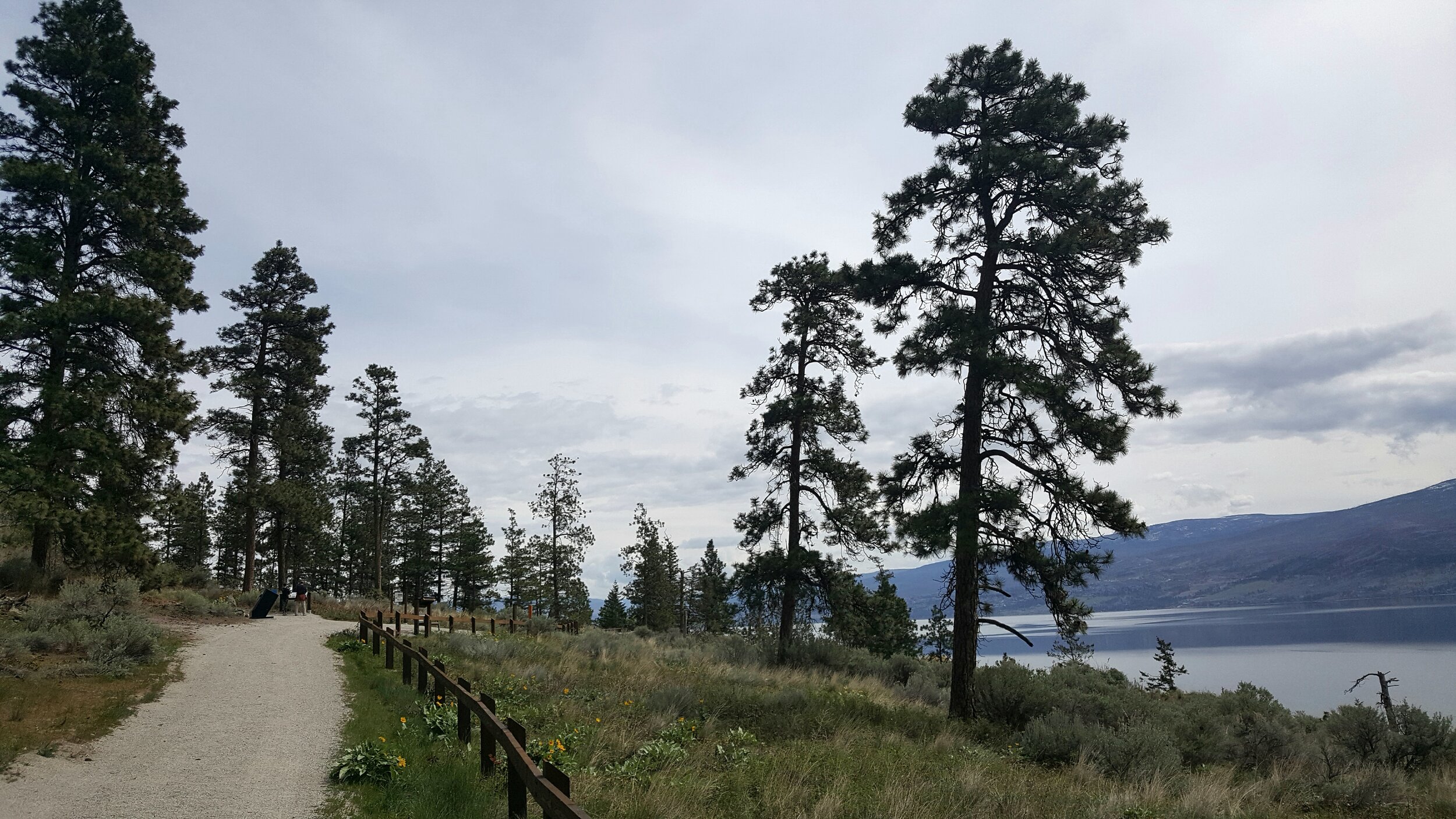
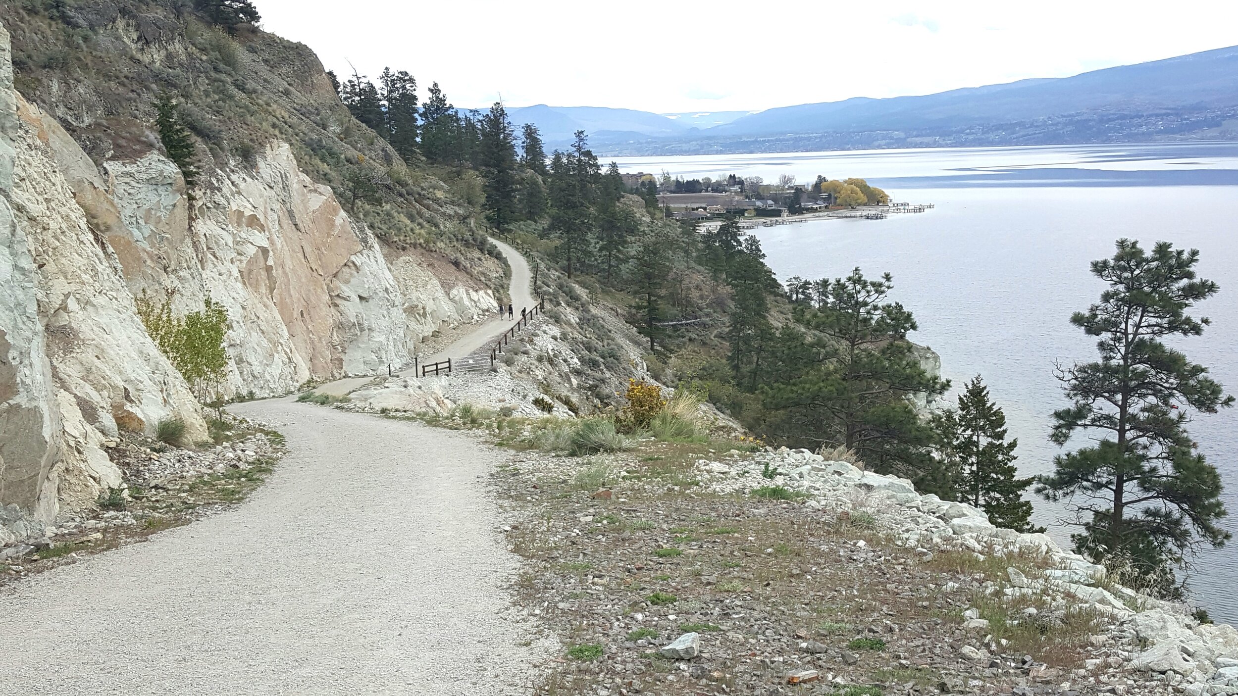
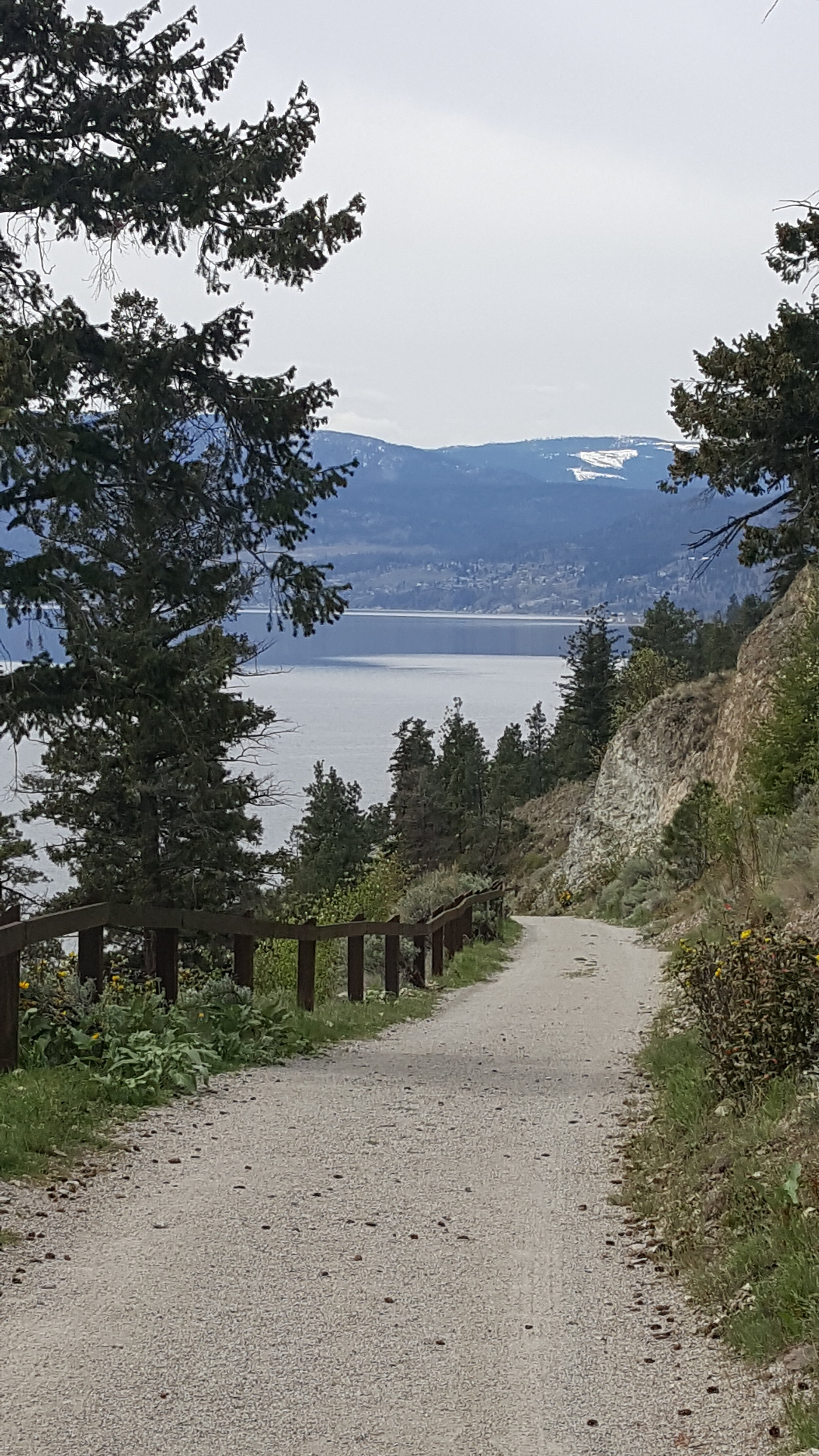
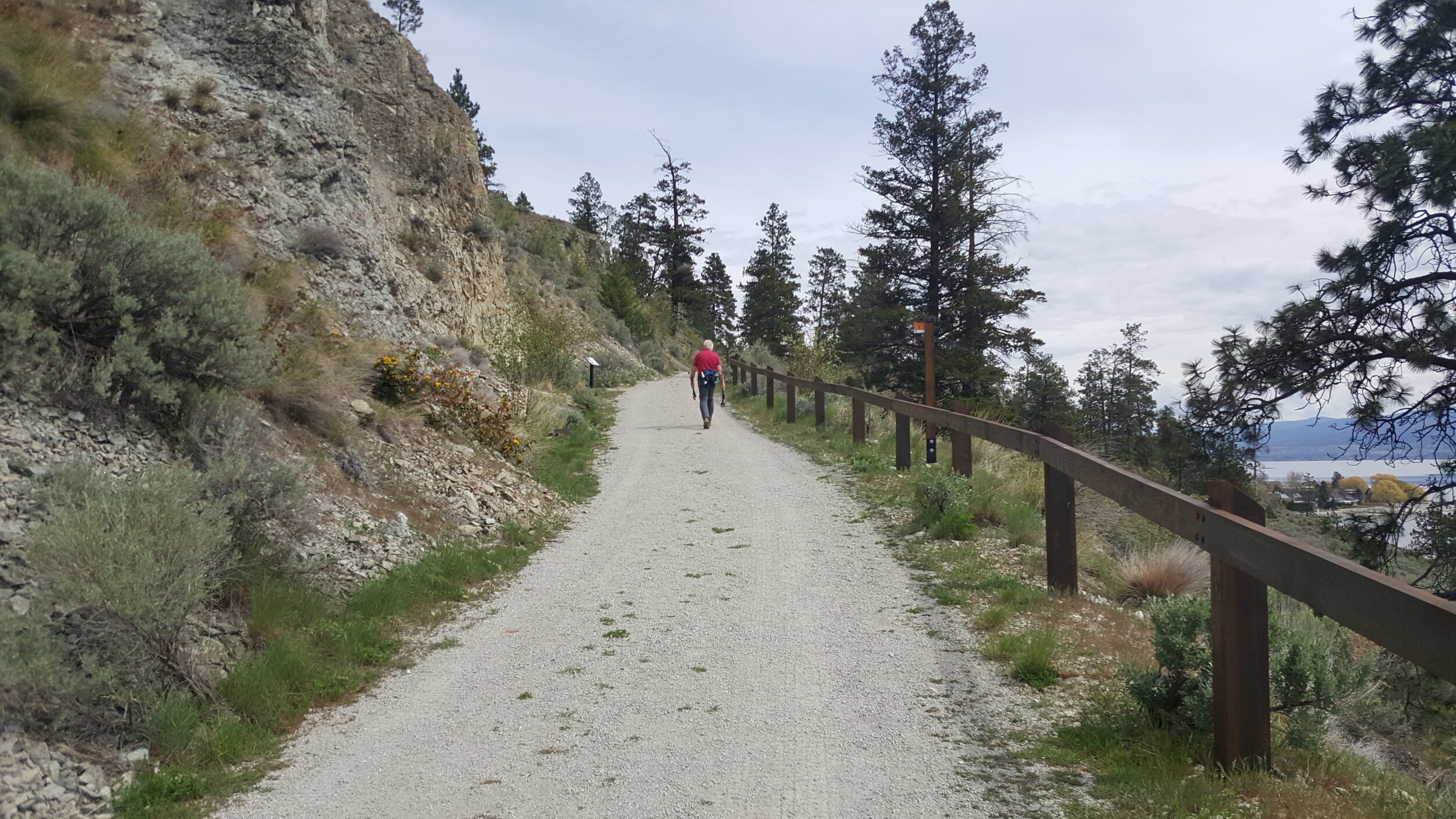
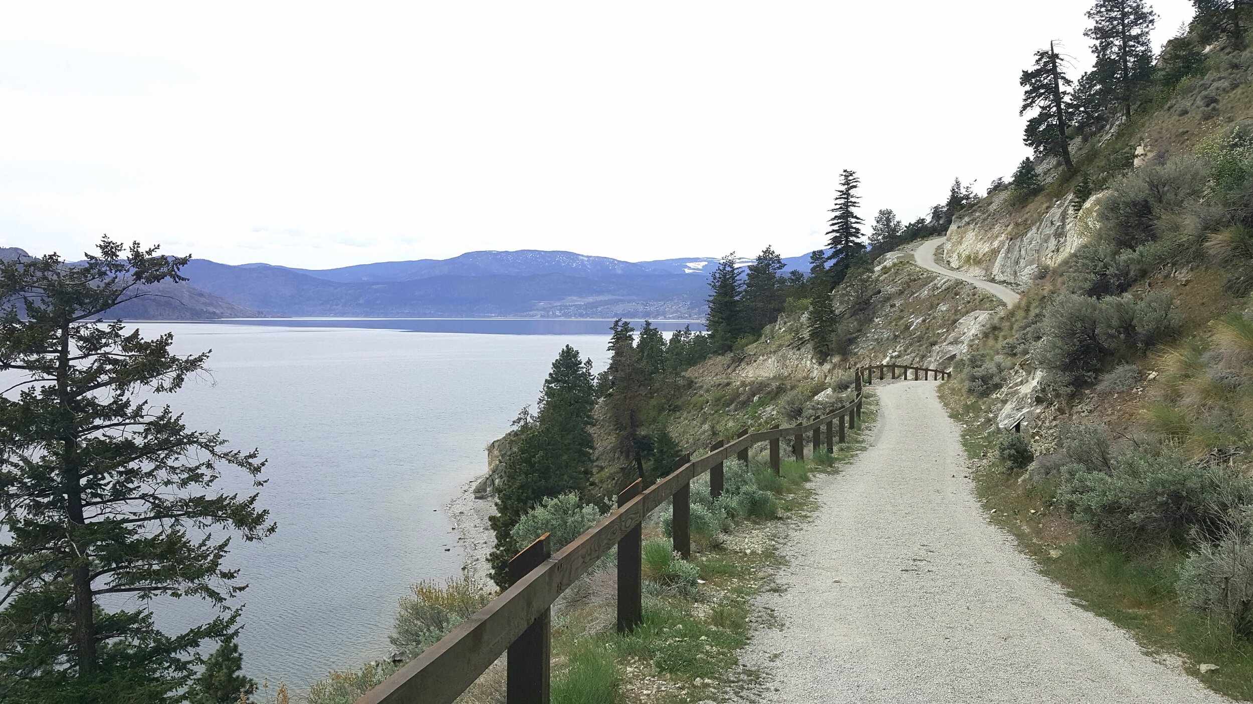
Goats Peak Park is one of the newest regional parks in the Okanagan, situated on the bluffs over Lake Okanagan between West Kelowna and Peachland. When it opened in the fall of 2018 it established a very important piece of the Trail of the Okanagans and is shown in green on the map. There is currently no safe cycle route between the two communities - travel along Highway 97 is not recommended (red line on map). The Big Sage Trail in Goats Peak Park is a former private gravel drive with spectacular views over the lake and to Okanagan Mountain Park. It is accessed off Seclusion Bay road on the Peachland side where
there is a small parking lot at the trail head. This trail, while short, has some elevation that is easy to climb on an e-bike. For hikers there is a second trail at the north end that climbs to the summit and a viewing platform. At this time Goats Peak Park does not connect fully to West Kelowna (red trail on map). There is a private property at the north end that blocks the
route that when developed in the future will include the completion of the trail to Gellatly Bay.
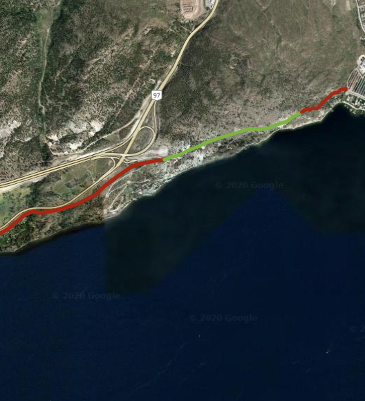
green line Section 2 - Big Sage Trail; red line south Gap 2 - Drought Hill; red line north Gap 1 - Private Property
Google Maps Directions
Trailforks Directions
Trail Length: 1.4 km one way Trail Type: Graded compacted gravel roadway with 86 m of elevation